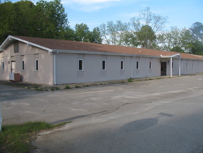
Property Record
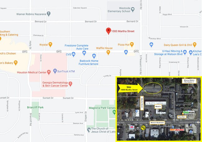
1000 Martha St, Warner Robins, GA 31093
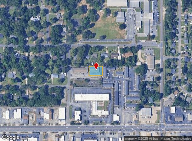
NEARBY LISTINGS FOR SALE OR LEASE
Property Detail
1000 Martha St
0W038M14C000
Wr Downtown 300 Ff
Officebuilding
TRACT 4 PB 13/278 191/5TH
X
Houston
13289C0200B
Georgia
2024
0.32 AC
2024
Perry/Warner Robins
020111
Other Market Areas
5,400 SF
Warner Robins, GA
DEMOGRAPHICS near 1000 Martha St
1 Mile
3 Mile
5 Mile
2024 Total Population
9,379
53,686
92,172
2029 Population
10,303
59,003
100,980
Pop Growth 2024-2029
+ 9.85%
+ 9.90%
+ 9.56%
Average Age
36
37
38
2024 Total Households
3,481
21,744
36,592
HH Growth 2024-2029
+ 9.68%
+ 9.76%
+ 9.40%
Median Household Inc
$41,825
$51,919
$59,821
Avg Household Size
2.50
2.40
2.40
2024 Avg HH Vehicles
2.00
2.00
2.00
Median Home Value
$86,069
$113,427
$147,188
Median Year Built
1962
1976
1985
Nearby Places
Map Layers
Map Styles
 Street
 Aerial
- Restaurants
- Banks
- Shops
- Fitness
- Groceries
SALE & LEASE HISTORY
LISTING DATE
SALE/LEASE

Nov 06, 2020
For Lease
Aug 04, 2020
For Sale
Nearby Properties
Address
Land Use
TOTAL SIZE
Lot Size
Zoning
Address
Land Use
TOTAL SIZE
Lot Size
Zoning
88,965 SF
18.72 AC
R2
Address
Land Use
TOTAL SIZE
Lot Size
Zoning
11,658 SF
30.23 AC
R2
Address
Land Use
TOTAL SIZE
Lot Size
Zoning
10,568 SF
35.44 AC
R4
Address
Land Use
TOTAL SIZE
Lot Size
Zoning
100,320 SF
26.91 AC
C2
Address
Land Use
TOTAL SIZE
Lot Size
Zoning
304,246 SF
23.11 AC
C2
Address
Land Use
TOTAL SIZE
Lot Size
Zoning
178,400 SF
49.03 AC
R2
Address
Land Use
TOTAL SIZE
Lot Size
Zoning
3,199 SF
41.42 AC
R4
Address
Land Use
TOTAL SIZE
Lot Size
Zoning
92,930 SF
18.66 AC
C2
Address
Land Use
TOTAL SIZE
Lot Size
Zoning
842,179 SF
101.75 AC
M2
Address
Land Use
TOTAL SIZE
Lot Size
Zoning
223,608 SF
22.40 AC
C2
Address
Land Use
TOTAL SIZE
Lot Size
Zoning
11,200 SF
7.60 AC
R4
Address
Land Use
TOTAL SIZE
Lot Size
Zoning
15,184 SF
14.03 AC
R4
Address
Land Use
TOTAL SIZE
Lot Size
Zoning
210,408 SF
47.18 AC
C2
Address
Land Use
TOTAL SIZE
Lot Size
Zoning
19,200 SF
14.70 AC
R4
Address
Land Use
TOTAL SIZE
Lot Size
Zoning
6,336 SF
27.16 AC
R4
Address
Land Use
TOTAL SIZE
Lot Size
Zoning
156,000 SF
19.25 AC
R2
Address
Land Use
TOTAL SIZE
Lot Size
Zoning
17,832 SF
13.60 AC
R4
Address
Land Use
TOTAL SIZE
Lot Size
Zoning
128,540 SF
32.26 AC
R2
Address
Land Use
TOTAL SIZE
Lot Size
Zoning
139,016 SF
24.71 AC
C2
Address
Land Use
TOTAL SIZE
Lot Size
Zoning
39,810 SF
26.92 AC
C1
Address
Land Use
TOTAL SIZE
Lot Size
Zoning
132,851 SF
24.05 AC
C2
Address
Land Use
TOTAL SIZE
Lot Size
Zoning
61,628 SF
45 AC
C2
Address
Land Use
TOTAL SIZE
Lot Size
Zoning
120,000 SF
19.03 AC
R3
Address
Land Use
TOTAL SIZE
Lot Size
Zoning
121,500 SF
10 AC
R2
Address
Land Use
TOTAL SIZE
Lot Size
Zoning
93,450 SF
11.16 AC
R2
Address
Land Use
TOTAL SIZE
Lot Size
Zoning
60,000 SF
8.95 AC
C3
Address
Land Use
TOTAL SIZE
Lot Size
Zoning
25,062 SF
R4
Address
Land Use
TOTAL SIZE
Lot Size
Zoning
25,062 SF
R4
Address
Land Use
TOTAL SIZE
Lot Size
Zoning
16,576 SF
13.47 AC
R4
Address
Land Use
TOTAL SIZE
Lot Size
Zoning
75,400 SF
12.12 AC
R2
The World's #1 Commercial Real Estate Marketplace
Connect with us
© 2025 CoStar Group
The information above has been obtained from sources believed reliable. While we do not doubt its accuracy we have not verified it and make no guarantee, warranty or representation about it. It is your responsibility to independently confirm its accuracy and completeness. Any projections, opinions, assumptions, or estimates used are for example only and do not represent the current or future performance of the property. The value of this transaction to you depends on tax and other factors which should be evaluated by your tax, financial, and legal advisors. You and your advisors should conduct a careful, independent investigation of the property to determine to your satisfaction the suitability of the property for your needs.